Interactive Maps
Mount Vernon to Anacostia River
Search Potomac Sites
Also Explore
| The Hudson River Guide | The Delaware River Guide |
| NEW! The Connecticut River Guide | |
Indian Head Monitoring Site
River Monitoring Site

Federal and state agencies maintain river level monitors throughout the Potomac River Basin. The U.S.Geological Survey compiles real-time information from river monitors, in cooperation with the U.S. Army Corps of Engineers and the National Oceanic and Atmospheric Administration (NOAA).
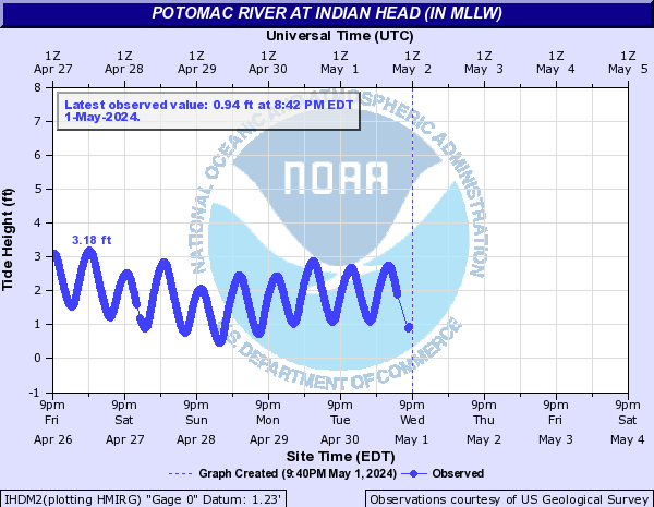
The current NOAA online observations and forecast for the Potomac at Indian Head, MD, is summarized below.

Nearby Potomac River Stream Monitors | |
Upstream | Downstream |
To view a map of Potomac River Monitors, select this link. | |
Suggested Links
Contact Information
National Oceanic and Atmospheric Admin.
National Buoy Data Center
Stennis Space Center MS 39529
Website
