
Connecticut River Guide Interactive Maps
| The Upper Connecticut | Boat Ramps and Kayak Access |
| The Middle Connecticut | Bridges and Ferries |
| The Lower Connecticut | Parks and Historic Sites |
Search Connecticut Sites
Also Explore
| The Delaware River Guide | The Potomac River Guide |
| The Hudson River | |
Putnam Bridge Trail
Local Park
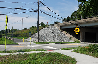
The Putnam Bridge Trail along the Connecticut River near Glastonbury, Connecticut, is a newly opened pathway that provides non-motorized access across the river. This trail connects the shared-use path on the Putnam Bridge to Great Meadow Road in Wethersfield and Naubuc Avenue in Glastonbury. It offers a safe and convenient route for pedestrians and cyclists, allowing them to cross the river without needing a motor vehicle. The trail also links to the Goodwin University trails in East Hartford, enhancing the network of recreational and transportation options in the area. This project, funded by the state and created by the Connecticut Department of Transportation, aims to promote active transportation and provide a scenic recreational opportunity for the local communities. Access to South Meadows Greenway along the Connecticut River. The Putnam Bridge Trail follows Route 3 near Keeney Cove and goes across the Putnam Bridge. On the other side of the Putnam Bridge is the Great Meadows Road parking area.
Suggested Links
Contact Information
CTDOT
Putnam Bridge
Glastonbury, CT 06033
Website